

Real-Time data management at Amsterdam's largest event
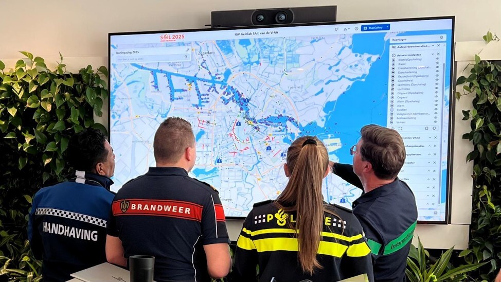
An interactive digital twin on which supervisory staff, the fire service, police and the safety region we able to see in real time what is happening in the Amsterdam waterfront area during SAIL 2025. Avineon Tensing played an important role in the production process of this digital twin as a partner of the Amsterdam-Amstelland Safety Region.
When managing an event that effectively doubles a city's population overnight, traditional static maps are no longer enough. For SAIL Amsterdam 2025, maintaining public safety and operational efficiency required a shift from historical data to real-time intelligence.
At Avineon Tensing, we used Safe Software’s FME to build a dynamic, real-time Digital Twin that enabled emergency services and event organisers to manage complex urban and maritime environments proactively.
Did you know that...
- There were 2.5 million visitors at SAIL 2025
- SAIL was the largest freely accessible event in the Netherlands
- Millions of location positions on the water were measured for the purposes of crowd management
- Avineon Tensing was the integration partner to the Amsterdam-Amstelland Safety Region for SAIL 2025

The event: SAIL Amsterdam 2025
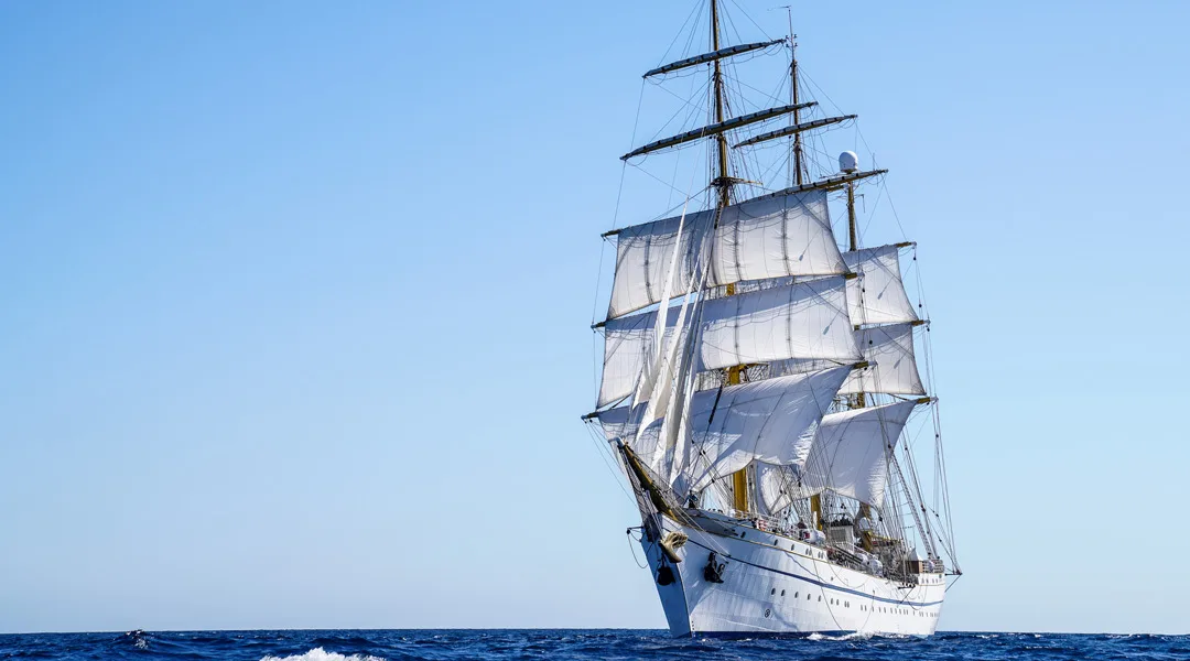
SAIL Amsterdam is the largest freely accessible five-day event in the Netherlands. Celebrating its 10th edition and 50th anniversary in 2025, the sheer scale of the festival presents an unprecedented logistical challenge:
- The event draws 1 million visitors, temporarily doubling the typical 500,000 daily population in the surrounding areas.
- Over 10,000 ships from more than 20 countries navigate the waterways.
- The fleet comprises four distinct types of ships: towering tall ships, naval defence vessels, maritime heritage boats, and commercial boating.
With millions of moving parts across land and water, safety and coordination are paramount. Police, Fire, and City Enforcement officers require immediate visibility over the entire landscape to anticipate bottlenecks, manage crowds, and respond to incidents before they escalate.

The challenge: building a Common Operational Picture (COP)
To manage an event of this magnitude safely, all emergency and operational teams must work from the same live map - a Common Operational Picture (COP).
Historically, sharing data between different agencies resulted in a tangled, unscalable web of point-to-point connections. Legacy data providers were relying on on-premise databases and static SOAP or REST APIs, which are poorly suited for high-velocity, real-time environments.
To provide true proactive crowd and traffic management, the Avineon Tensing team needed to shift the architecture to a highly scalable Hub and Spoke model. This real-time Digital Twin ingests live feeds from across the city, generating predictive intelligence and live monitoring:
- Drone Detection: Monitoring drone locations, pilot coordinates, flight paths, and no-fly zone breaches.
- Vessel Tracking: Live AIS and shore radar feeds capturing the movements of up to 2,500 vessels simultaneously.
- Traffic & Pedestrian Flow: Monitoring car road networks, processing feeds from pedestrian tracking cameras, and calculating canal occupancy using RFID beacons and spatial hexagons.
- Predictive Modelling: Live smoke plume modelling based on local wind speeds, heat modelling for deploying additional water points, and crowd simulation.
The Solution: A Live Picture, Powered by FME
Bringing the Common Operating Picture to life meant pulling together data from dozens of different systems. Each with its own format, vendor, and update rhythm, and turning it into a single, reliable view on the map, in near real time.
That's the role FME plays: the central integration engine that connects legacy systems to modern, live data streams. Rather than building a one-off solution, Avineon Tensing configured FME to handle three things at once.
It brings every source together.
Maritime traffic, drone detection across the waterways, and crowd movement from cameras and canal sensors all feed in continuously. FME keeps these streams current, so the map reflects what's happening on the water and along the quays as it unfolds.
It makes messy data usable.
Every source speaks a slightly different language: spreadsheets, geospatial files, live data feeds. FME interprets each one and standardises it into a single, consistent format the live map can read instantly, so nothing has to be manually reconciled.
It keeps the picture live.
Instead of waiting on periodic database refreshes, FME pushes the harmonised data straight through to the dashboards operators actually watch, keeping the view continuous rather than snapshot-by-snapshot.
And because FME's design is modular, the same core logic can be reused and extended. Adding a new sensor, feed, or emergency data source is a matter of adjusting settings, not rebuilding the system. That flexibility is what lets the setup scale as the event's needs change.

Bring real-time intelligence to your operations
Whether you are managing a major public event, monitoring smart city infrastructure, or coordinating multi-agency emergency responses here in the UK, real-time spatial data is critical.
Ready to move beyond static maps? Contact the Avineon Tensing UK team today to discover how we can help you build your own real-time Common Operational Picture using the power of FME.


