The FME Platform Deltas You Might Not Know Existed
Here's something for your Friday afternoon (apologies if you aren't reading this on a Friday afternoon!). You're running FME Form, you've got your workflows humming along and everything feels pretty platform-agnostic, right? Windows, Linux, Mac are all supported by FME Form and it basically looks identical on each platform these days.
Except... they're not.
Pop quiz time: If you take FME Form on Windows as your baseline, how many more formats do you reckon it supports compared to Linux?
Go on, have a guess. Ten? Maybe twenty if you're feeling bold?
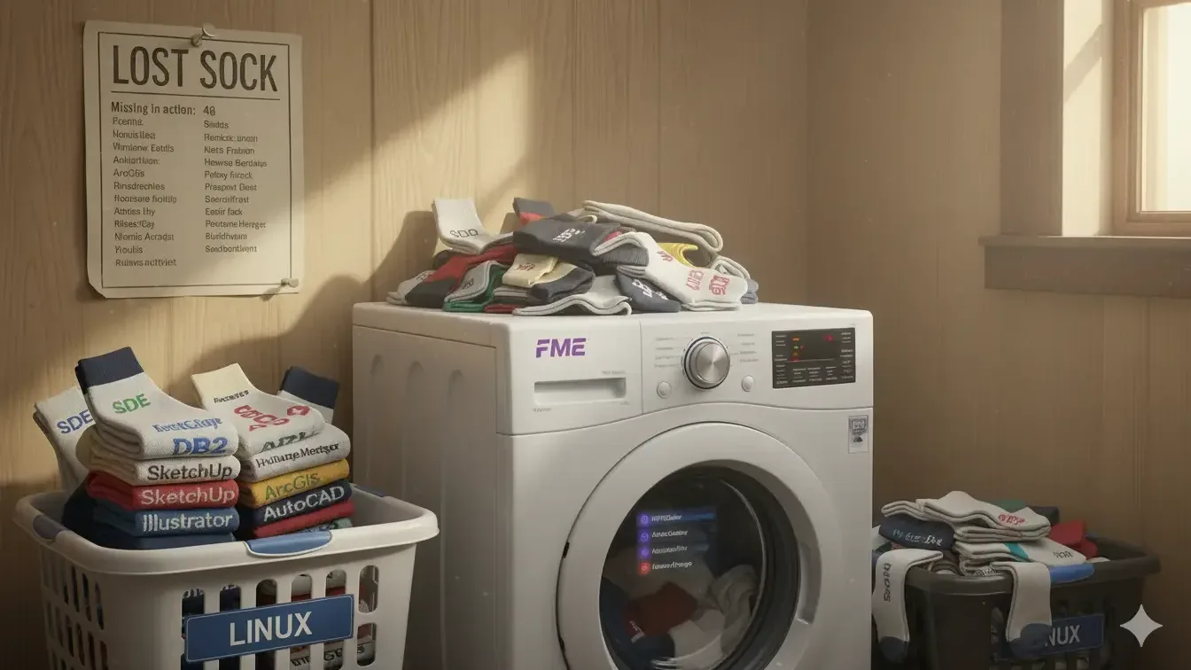
Try 48.
Yeah, we know. That's the reaction we had too.
Checking the Delta
Safe Software have their integrations pages - it's all there, publicly available. But here's the thing: that page doesn't actually tell you the delta.
So, to answer one of our customer's technical support questions, Simon did what any self-respecting FME Technical pro would do. He built a workspace to work it out.
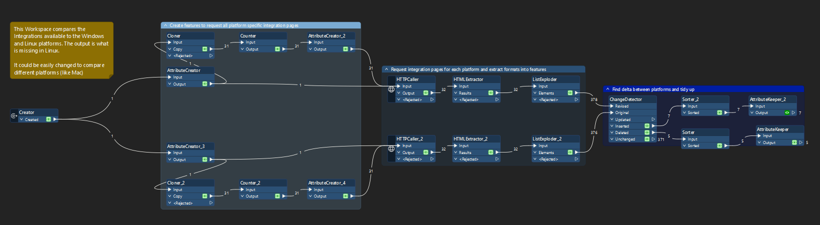
The workspace itself creates URLs for both platforms, hits all the paginated integration pages using HTTPCaller transformers, extracts the format names with the HTMLExtractor, explodes them into individual features, then uses the ChangeDetector to spot what's supported on Windows but missing from Linux. Sorted, filtered and displayed.
And the numbers? Windows supports 426 formats. Linux supports 378.
What You're Actually Missing on Linux
Now, before anyone panics - what are these 48 formats? We're not talking about shapefile or GeoJSON here. These are the specialist formats that only run on Windows. The ones that make you grateful someone else already sorted out the Reader/Writer!
Here's what Linux users are missing out on:
- The Esri ecosystem: All the Enterprise Geodatabase (SDE) variants, File Geodatabase readers (the API one is still available), ArcGIS Knowledge, Layer files, Map Documents... basically, if it says "Geodatabase" and has brackets after it, it's usually Windows-only.
- The legacy spatial database gang: IBM DB2 (and DB2 Spatial), Informix, Microsoft Access, SQL Server with all their spatial flavours. Azure SQL Database variants too.
- Proprietary GIS platforms: GE Smallworld, GeoMedia warehouses, MapInfo Extended TAB, Bentley i-model. These are the enterprise systems that, let's face it, were built in a Windows world, when the concept of a mobile phone was a landline with a really long flex!
- The niche formats: Adobe Illustrator via Avenza MAPublisher, AutoCAD Map 3D, Trimble SketchUp, even Microsoft DirectX. You know, for those times when someone asks you to convert a 3D model into a spatial dataset!
The full list is at the bottom if you're the type who likes scrolling through format names. We won't judge.
But Here's the Thing About JDBC
Simon made a good point (he usually does): technically, you can access some of those database formats using JDBC drivers. So it's not like you're completely sunk if you're running Linux and need to hit a SQL Server database. You've just got to use the JDBC route instead of the native client.
Which is fine - until you hit that one edge case where the native client does something the JDBC driver doesn't quite handle the same way, and then you're debugging connection strings for a while.
The MacOS Situation (If You're Wondering)
Whilst we were at it, we checked Mac too. Mac sits at 376 formats – almost the same as Linux, but with its own quirks:
Mac has but Linux doesn't (5 formats):
CKAN • Socrata • STAC Metadata • Trimble SketchUp • Unfolded
Linux has but Mac doesn't (7 formats):
Bentley MicroStation GeoGraphics • Epic Games Unreal Datasmith • Extensis MrSID • Intergraph MGE • Microsoft DirectDraw Surface • ODBC 3.x • Virtual Reality Modelling Language (VRML97)
So, if you're desperate to work with VRML97 files (and honestly, what year is this?) - you'll want Linux over Mac.
What This Actually Means for You
Here's the practical bit. If you're running FME on Linux servers - which loads of people do because it's stable, cost-effective, and plays nicely with containerisation – you're probably fine. Most modern workflows don't touch these legacy formats anyway.
But if you're migrating from Windows to Linux, or you're architecting a new FME Flow environment, you need to know about this delta. Because the one format you don't support will inevitably be the one you might have a requirement for. It's always the way, isn't it!
The Windows dominance here isn't surprising. These are mostly formats tied to Windows-native applications or databases that were never designed with cross-platform deployment in mind. Enterprise Geodatabase, SQL Server, Access – they grew up in a Windows world and their FME integration reflects that.
Got thoughts on this? Running into format issues on non-Windows platforms? We'd genuinely love to hear about it. As Safe Software FME Partners, we spend a lot of time thinking about this stuff. Sometimes too much time!
At least now you've got a decent pub quiz question for your next team meeting.
The Full 48-Format List (For the Completists)
Adobe Illustrator • Avenza MAPublisher • AutoCAD Map 3D • Autodesk IMX (FDO) • Autodesk MapGuide Enterprise SDF • Bentley i-model Interchange Format • CARIS Spatial Archive (CSAR) • CARIS Spatial Archive Point Cloud (CSARPC) • CKAN • Esri ArcGIS Knowledge • Esri ArcGIS Layer • Esri ArcGIS Map Document • Esri Enterprise Geodatabase (SDE) • Esri File Geodatabase (FGDB) • Esri Geodatabase (ArcSDE Geodatabase Raster Catalogue) • Esri Geodatabase (ArcSDE Geodatabase Raster Dataset) • Esri Geodatabase (ArcSDE Geodb Mosaic Dataset) • Esri Geodatabase (File Geodatabase Raster Catalogue) • Esri Geodatabase (File Geodatabase Raster Dataset) • Esri Geodatabase (File Geodb Mosaic Dataset) • Esri Geodatabase (Personal Geodb) • Esri Geodatabase (XML Workspace Document) • GE Smallworld • GeoConcept Map • GeoMedia Access Warehouse • GeoMedia SQL Server Warehouse • Graphic Technologies, Inc. (GTI) GTViewer • IBM DB2 • IBM DB2 Spatial • IBM Db2 Warehouse on Cloud • IBM Db2 Warehouse on Cloud Spatial • IBM Informix • IBM Informix Spatial • IDRISI Vector Format • MapInfo Extended TAB • MapInfo TAB (EFAL- Tech Preview) • Microsoft Access (MDB) • Microsoft Azure SQL Database • Microsoft Azure SQL Database Spatial • Microsoft DirectX • Microsoft SQL Server • Microsoft SQL Server Spatial • Pointools POD • Precisely Multi-Resolution Raster (MRR) • STAC Metadata • Socrata • Trimble SketchUp • Unfolded • Z+F LaserControl ZFS


